Tuesday, January 27, 2009

1/27/09 2:00PM Update

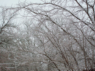
1" of ice and still accumulating at this time

Roads are ice
Cars are ice

Everything is ICE

Pictures below:


1/27/09 4:50AM

Significant Ice Totals from Elizabethtown on South while upto 4 inches of snow towards Louisville has fell since the beginning of the storm...

I've already received 1/2 inch ice accumulations with hardly any snow at all. Roads are passable in the central Kentucky area.

We will have a lull and depending on temperature tonights main storm could be worse then what we've received today.

Once daylight arises I will snap some photos of my little community.

All in all, Louisville got their snow. E'town will have a double shot of ICE STORM conditions that will lead to power outages and possible line breakages and limbs falling.

More this morning/early afternoon.

Monday, January 26, 2009

Television Station Predictions

Totals for each television station are as follows - Louisville only:

KEVIN HARNED - WAVE: 3-5"
JAMIE MARTIN - WHAS: 3-6"
MATT MILOSVICH: WLKY: 2-4" (Quote: With Alot of Stuff)
MARC WEINBURG: WDRB: 4-7" ( Emphasized Severe Icing in E'town )

These will be updated later this afternoon with more meteo predictions:

Just an update... Seems like possibly the warm air may win this and this become a SIGNIFICANT and DANGEROUS ICING Event Shaping up especially around Elizabethtown/Hardinsburg/Bluegrass Parkway Corridor.

More later.

Picture Problems

Having some picture problems that I can't figure out so expect a big summary of my thoughts on the storm including an overview on what each TV station is saying about it later this afternoon.

1/26/09 10:15AM

Winter Storm 2009:

Here are the new updates from HPC ( Hydrological Prediction Center ):

First the color codes for each legend posted:

  • RED - HIGH RISK 70% PROBABILITY
  • GREEN - MEDIUM RISK 40% PROBABILITY
  • BLUE - SLIGHT RISK 10% PROBABLITY
Second, This is the Monday probability for .25" of ice. The RED or High Risk extends into Central Kentucky from a starting point of about Richmond, Kentucky towards Paducah. I feel we will see this with warm air aloft will cause this type of precip. Ice storm conditions will develop overnight in Central Kentucky.


This is Tuesday .25" Probability Risk for our area. As you can see Central Kentucky is right in the bullseye for HIGH RISK. The Weather Channel is feeling this event will be more of an ice event as far north as Louisville and is mentioning upto 1 to 1 1/2" of Ice. They have mentioned several times " Crippling ". While I don't believe we will see that much ice and I don't think this will be like the lexington ice storm expect power outages and limbs down.


Having Computer Problems - I will finish my thoughts later on.


1/26/09 Early Morning #3: Issuance of Warnings!

As predicted, ICE STORM WARNING has been issued from Elizabethtown south and Winter Storm Warning has been issued from Elizabethtown north.


Expected totals remain the same for now and really don't expect them to change much unless something drastic changes today.


New NWS Louisville Map:


I have to give NWS Louisville credit as they are on the ball and all over this storm, as you can tell the other NWS officers hasn't made any changes except Louisville.


We have one of the best weather offices in the country and it is very obvious of such a bold quote.


Updates thru out the day

1/26/09: WINTER STORM WARNING!

Winter Storm Warning has been issued from 10 PM Monday Evening thru 10AM Wednesday Morning!

1/26/09 Early Morning #2: MFD Discussion

TUESDAY-WEDNESDAY NIGHT......SIGNIFICANT ICE STORM AND MORE SNOW TUESDAY-WEDNESDAY MORNING


TUESDAY...INVERTED TROUGH WILL CONTINUE TO MOVE TOWARD THE REGIONWITH AMPLE MOISTURE FROM THE GULF. TUES MORN...SNOW WILL BEONGOING ACROSS THE NORTH...WITH FREEZING RAIN AND SLEET SOUTH...ANDA MIX IN THE CENTRAL PORTION OF THE CWA. WARMER AIR ALOFT WILL PUSHNORTHWARD...HELPING SFC TEMPS TO INCREASE A TAD TOO. HAVE INCREASINGSFC TEMPS THROUGHOUT THE DAY. QPF AMOUNTS IN THE MORNING SHOULDYIELD ABOUT A TENTH TO A QUARTER INCH OF ICE ACROSS CENTRAL-SOUTHCENTRAL KY...WITH SNOW AND SLEET AMOUNTS OF 2 INCHES AND LOCALLYHIGHER OVER THE NORTH. THERE IS THE POTENTIAL FOR PERHAPS 4 INCHESOF ADDITIONAL SNOW FROM 12-18Z TUESDAY ACROSS THE NORTH. BYMIDDAY...THE FIRST WAVE OF PRECIP WILL WANE AND WE WILL HAVE A LULLIN THE PRECIP. HOWEVER...TEMPS WILL INCREASE THRU THE DAY ANDWHATEVER PRECIP WILL BE AROUND WILL SHIFT NORTH. THE ICE STORM WILLMOVE TO CENTRAL KY UP TO THE OHIO RIVER AND NRN BLUEGRASS...AND OURSRN/SERN CWA WILL HAVE JUST A COLD RAIN. OUR INDIANA COUNTIES WILLCHANGEOVER FROM ALL SNOW TO A SNOW AND SLEET MIX. WHATEVER ICE FELLACROSS THE FAR S/SE MAY MELT DURING THE DAY TUESDAY AS TEMPS WARM.TUESDAY AFTERNOON AMOUNTS WILL STILL YIELD ABOUT A QUARTER INCH OFICE THRU THE CENTRAL PORTION OF THE CWA...WITH MAYBE AN ADDITIONALINCH OF SLEET/SNOW OVER THE NORTH.


TUESDAY NIGHT...INVERTED TROUGH/SFC LOW WILL BE OVER THE FAR SERNCWA. WINDS WILL SHIFT AROUND TO THE N/NW AND A SECOND WAVE A PRECIPWILL MOVE INTO OUR CWA WITH THE MAX QPF AMOUNTS OVER THE SERN CWA.WITH THE WINDS SHIFTING TO THE NW...COLDER AIR BEHIND THE SFC TROUGHWILL WORK INTO THE CWA. POINTS ACROSS THE N/NW WILL CHANGE BACK OVERTO ALL SNOW...RAIN ACROSS THE SERN CWA WILL EVENTUALLY EXIT TO THEEAST...AND POINTS IN BETWEEN WILL STILL SEE A WINTRY MIX...MOSTLIKELY A SLEET/FZRA/SNOW MEDLEY. AFTER MIDNIGHT AND TOWARDS WEDDAWN...PRECIP WILL MOVE OFF TO THE EAST...WITH PRECIP CHANGING OVERTO ALL SNOW EXCEPT OVER THE SERN CWA WHERE A SLEET/SNOW MIX ISLIKELY. ADDITIONAL ICE ACCUMS OVER THE ERN/SERN CWA WILL BE ABOUT ATENTH OR LESS...WITH ADDITIONAL SNOW ACCUMS OF AROUND AN INCH BEFOREWEDNESDAY DAWN.


Going to be a wild storm for sure and I'll be updating this thru out the whole event along with pictures!

1/26/09 Early Morning

I will highlight key wording from NWS in their MFD ( Morning Forecast Discussion )


I will post this in two blogs for easier reading.


MAIN FORECAST CHALLENGE FOR THE SHORT TERM PERIOD WILL BE SIGNIFICANT WEATHER BEGINNING TO IMPACT THE AREA TONIGHT.


DURING THE DAYTIME HOURS...HIGH PRESSURE BEGINS TO BREAK DOWN OFFTHE COAST OF FLORIDA AS A SURFACE LOW BEGINS TO NOSE INTO THE REGIONFROM THE SOUTHERN PLAINS. AS MOISTURE INCREASES SO WILL LOW LEVELCLOUDS DURING THE DAY AND CONDITIONS WILL REMAIN MOSTLY CLOUDY.EXPECT HIGHS AROUND 30 NORTH TO NEAR 40 ALONG THE KY/TN BORDER.


BY MONDAY EVENING...AN INVERTED SURFACE TROUGH BEGINS TO SET UP OVERTHE REGION AND STRENGTHEN DURING THE OVERNIGHT HOURS. PLENTY OF GULFMOISTURE WILL BE TAPPED AND MODELS ARE FAIRLY CONSISTENT IN BRINGINGIN AREA OF HIGH QPF BY 03Z IN THE FAR WEST AND SPREADING EASTWARDTHROUGH THE NIGHT. SATURATED THERMODYNAMIC PROFILES...MID AND UPPERLEVEL JET SUPPORT ALONG WITH SOME FRONTOGENETICAL FORCING WILL HELPCREATE HIGH PRECIPITATION RATES AFTER 06Z TUESDAY. CURRENT FORECASTSOUNDINGS INDICATE THAT PRECIPITATION WILL BE ALL SNOW ACROSSSOUTHERN INDIANA AND NORTH CENTRAL KENTUCKY THROUGH MONDAY NIGHT.FURTHER SOUTH ACROSS CENTRAL KENTUCKY...A MIX OF SNOW AND SLEET ISEXPECTED AND SOUTH CENTRAL KENTUCKY CAN EXPECT MAINLY FREEZING RAINAND SLEET THROUGH MONDAY NIGHT AS WARMER AIR NOSES IN AT MID LEVELS.


AT THIS TIME...QPF AMOUNTS AND THERMODYNAMIC PROFILES SUGGEST THATMODERATE TO HEAVY SNOWFALL WILL RESULT IN AROUND 4 INCHES OF SNOW ACCUMULATION ACROSS SOUTHERN INDIANA AND FAR NORTH CENTRALKENTUCKY...INCLUDING THE LOUISVILLE AND LEXINGTON METRO AREAS.FURTHER SOUTH WERE SOME SLEET IS EXPECTED...SNOW ACCUMULATIONAMOUNTS WILL BE AROUND 1 TO 3 INCHES DEPENDING ON THE AMOUNT OFSLEET THAT FALLS. ACROSS SOUTH CENTRAL KENTUCKY...AROUND ONE TO TWOTENTHS OF AN INCH OF ICE ACCUMULATION CAN BE EXPECTED.


PRECIPITATION WILL MOVE INTO WEST CENTRAL KENTUCKY AROUND 03ZTUESDAY AND ARRIVE IN LEX AROUND 06Z AND QUICKLY MOVE ACROSS THEREST OF THE FORECAST AREA. THEREFORE...EXPECT SLIGHTLY HIGHERPRECIPITATION AMOUNTS IN THE WEST THAN IN THE EAST...HOWEVER WITHPRECIP RATES NOT INCREASING UNTIL AFTER 06Z DO NOT EXPECT THISDIFFERENCE TO BE OF MUCH SIGNIFICANCE.


The most important part of this discussion:

A WINTER STORM WARNING IS PLANNED FOR THE NORTHERN TWO THIRDS OF THEFORECAST AREA FROM MONDAY EVENING THROUGH TUESDAY NIGHT.


AN ICE STORM WARNING WILL BE ISSUED FOR THE SOUTHERN THIRD OF THE FORECASTAREA FROM MONDAY EVENING THROUGH TUESDAY AFTERNOON.


I would predict to say the line will be from Elizabethtown northward will be issued under Winter Storm Warning and from Elizabethtown south to be issued as ICE STORM WARNING.


Areas that receive significant icing should expect prolong power outages and extended school closings.


This is only for MONDAY Discussion!

1/26/09: WINTER STORM WATCH!

The whole Kentuckiana area is under a Winter Storm Watch through Wednesday morning for the possibility of a major winter storm coming thru the area that could leave some areas with the slight chance of a foot of snow....


Here is the map of the winter storm watch:

This will be upgraded later this morning to a WINTER STORM WARNING.

Snow totals for now appear to be significant:

Southern Indiana: 6-9" With Locally Heavier Amounts ( Potential To Be All Snow)
North Central Kentucky: 4-7" With Upto 1/4" Ice Accumulations
Central Kentucky: 3-6" W/ 1/4 to 1/3" Ice Accumulations
South Central Kentucky: 1-2" with Upto 1/2" Ice Accumulations

Areas that receive more ice then snow could be crippling to power outages, trees down, power lines down, etc.

I will be blogging thru out the day and hope that you join me for updates. Feel free to comment on my blog and I will answer every comment.

School Situation: Expect Jefferson County schools to be dismissed most likely Tuesday and possibly Wednesday. Rural Districts expect possibly out til Thursday or even longer depending on Ice Accummulations.

I will update this blog when new runs come thru from HPC, GFS and NAM... This still needs to be fine tweaked!


1/26/09 First Post / Welcome

1/26/09:

First would like you welcome all to my weather blog, this blog will be updated during severe weather, winter weather, or anytype of weather that will be potent to the Kentuckiana area. Your comments, suggestions are very much appreciated.

Thanks